DMatlas is dedicated to objectively representing the geometric characteristics of geological phenomena, spatial contact relationships, and variations in the properties of subsurface geological units. To advance its 3D geological modeling technology, DMatlas focuses on optimizing modeling processes, establishing a shared geological model system, creating a knowledge-driven modeling system, and bolstering analytical capabilities to address uncertainties in model construction. Leveraging these enhancements, DMatlas integrates a unique customized modeling approach alongside stochastic modeling, enabling the comprehensive 3D modeling of various reservoir types. By employing innovative modeling workflows and interactive operations, DMatlas facilitates the creation of detailed and accurate geological models that reflect the complexity and diversity of subsurface structures, enhancing the understanding and visualization of geological features for a range of applications.
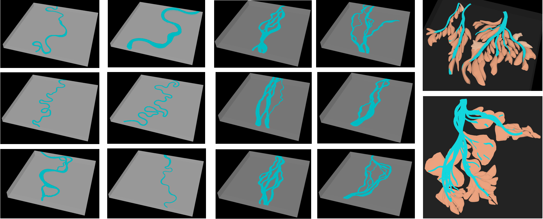
Customizing banded sand-bodies(e.g. channels)
Customizing lenticular sand-bodies(e.g. river mouth bars)
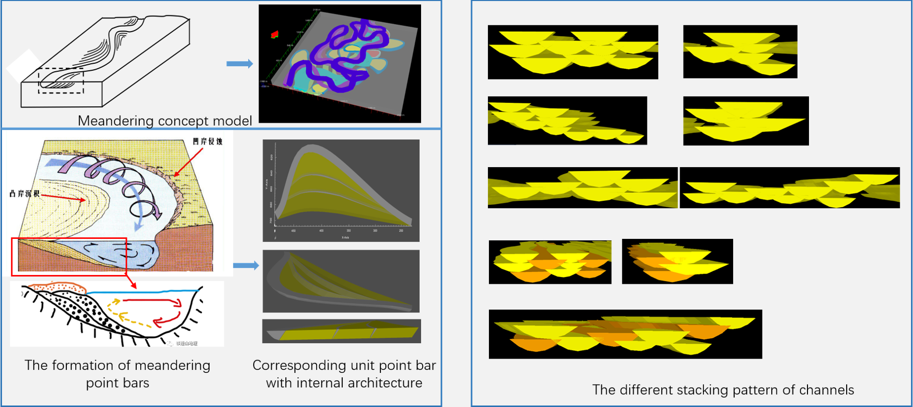
Constructing geological models in accordance with geological concepts based on geological understanding involves interpreting and integrating geological data to create accurate representations of subsurface structures, stratigraphy, and rock properties. By considering sedimentary facies principles, which dictate the characteristics and distribution of sedimentary deposits in different environments such as fluvial, deltaic, shoreline, and marine settings, geological models can be refined to accurately depict the sedimentary architecture. By incorporating these principles and laws into the modeling workflow, realistic and reliable geological models can be developed, aiding in various applications such as resource exploration, reservoir characterization, and geological hazard assessment.
This intuitive method of manually constructing concrete sand bodies serves as a valuable educational tool for classroom presentations, effectively demonstrating sedimentary processes and showcasing typical configurations of sand-body stacking. It enhances the learning experience by providing a hands-on approach that enables students to visually and practically understand the complexities of sedimentary deposition and the formation of geological structures.
The rich variety of sedimentary facies and sand body types not only allows for the creation of training images that are visually intuitive and aligned with geological concepts but also establishes a robust foundation for machine learning applications. DMatlas' capacity to efficiently construct diverse and intricate geological model libraries serves as a valuable resource for machine learning endeavors by providing a wide array of high-quality samples for training algorithms. This integration bridges the gap between traditional geological modeling practices and cutting-edge machine learning techniques, enabling the development of predictive models and automated processes that leverage the wealth of geological data captured within DMatlas' comprehensive model repositories.